WINDSTORM OR HAIL–A DISCUSSION
(June 2022)
|
|
INTRODUCTION
Commercial and personal lines insurance coverage forms and policies both cover windstorm and hail damage. As with fire and explosion, they do not define these terms. As a result, dictionary definitions and court precedents must be used to determine covered losses and those that are not. The Insurance Services Office (ISO) CP 10 10–Causes of Loss–Basic Form and CP 10 20–Causes of Loss–Broad Form cover windstorm and hail but exclude loss or damage caused by or that results from:
- Frost
- Cold weather
- Ice, snow, or sleet
Note: This does not include hail.
- Interior damage to buildings or structures and the personal property located inside a building or structure that is caused by rain, snow, sand, or dust unless these damaging elements entered the interior through breaches or openings made in the roof or walls
The last two exclusions specifically state that the exclusion applies regardless of whether the element was wind-driven or not.
CP 10 30–Causes of Loss–Special Form approaches things a bit differently. It does not specifically list windstorm or hail as covered, but coverage applies because neither is excluded. However, it excludes loss or damage caused by rain, snow, ice, or sleet, or damage to personal property in the open. It follows the pattern of the CP 10 10 and CP 10 12 by limiting damage to the interior of the building or structure and to personal property inside from rain, sleet, sand, or dust to apply only if a covered cause of loss first breaches or damages the building and that allows the elements to enter. The limitation states that coverage does not apply unless the building or structure is first breached or damaged even if the elements are wind-driven.
Related Court Cases:
"Opening" In Roof as Condition of Interior Damage Coverage Examined
Storm Damage Held Not Covered By Virtue Of Ice, Snow, or Sleet Exclusion
DEFINITIONS
Several terms must be defined to better understand the coverages provided. Each is the dictionary definition or as defined in scientific or research articles and papers. Black's Law Dictionary does not define any of these terms.
- Rain
The American
Heritage Science Dictionary
defines rain as water
that condenses from water vapor in the atmosphere that falls to Earth as
separate drops from clouds.
- Wind
The American
Heritage College Dictionary defines wind as moving air, especially a
natural and perceptible movement of air parallel to or along the ground.
The American Heritage Science Dictionary
defines wind as a current of air,
especially a natural one, that moves along or parallel to the ground, moving
from an area of high pressure to an area of low pressure.
- Windstorm
The American
Heritage College Dictionary
defines windstorm as a storm with high winds or violent gusts but with
little or no rain.
- Hail
The America
Heritage College Dictionary
defines hail as precipitation in the form of spherical or irregular
pellets of ice larger than 5 millimeters (0.2 inches) in diameter.
WINDSTORM
Wind and windstorm are different causes of loss. Consider the following loss examples:
- The light breeze that blows through the house from the front to the back often causes the front door to slam. This results in cracked window frames and panes.
- A storm door left ajar constantly slams against the outside wall of the house when the wind blows against it. This causes a crack to develop in the outside wall.
- A strong blast of wind enters the home through a mesh screen door and blows over a lamp.
Wind causes these losses, but the wind did not occur in the midst of a storm. Insurance coverage will not apply because the loss or damage is covered only when a direct result of windstorm.
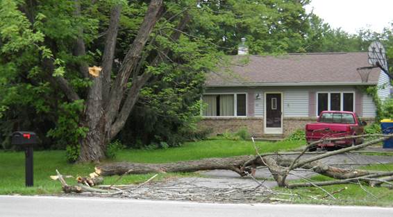
Windstorm refers only to the wind within the storm. It does not refer to the rain and water that may accompany it. This very important distinction is frequently made following a hurricane. Hurricanes and tornados are not defined in any insurance coverage, even though both terms contribute to the lively discussion of what is covered. Windstorm damage is limited to damage the wind causes. Water damage that may accompany the windstorm is not covered as windstorm. In addition, sand driven by wind is also excluded.
|
Examples: · Siding ripped from the side of a house is covered because the wind caused the siding to rip. · Sand driven by the wind through gaps in the windows, doors, and siding is not covered because the wind did not damage the structure. The sand did the damage. · A wind-driven wave surge floods a building. This is the major point of dispute following a hurricane. What damage did the wind cause, and what damage did the flood cause? |
HAIL
Hail falls along paths scientists call hail swaths. Their size can vary from a few acres to up to 10 miles wide, 100 miles long, and leave piles of hail that must be removed by snowplows or bulldozers. Hail causes significant damage to crops in the United States every year, in amounts that run into the hundreds of millions of dollars. Farmers cope with the hail hazard by purchasing insurance.
Hail in the United States is most prevalent in the area known as "Hail Alley." This consists of the states of Colorado, Kansas, Oklahoma, and Texas. Parts of this region average between seven and nine hail days per year. Hail is also much more common along mountain ranges because mountains force horizontal winds upwards. This intensifies the updrafts within thunderstorms and makes hail more likely.
WINDSTORM EXCLUSIONS AND DEDUCTIBLES
Many insurance companies issue policies that either exclude windstorm entirely or require a significant deductible because of concern about potential hurricane damage.
Properties subject to windstorm exclusions may be eligible for coverage in a Beach FAIR Plan. These plans are available in Alabama, Florida, Louisiana, Mississippi, North Carolina, South Carolina, and Texas. They cover real and personal property in the designated beach area. There are variations in the type of eligible property among the various states. Each state has a maximum limit per structure, but the limits change regularly. It is important to investigate the plans in each state to determine the cap. These plans are NOT a substitute for the coverage the National Flood Insurance Program (NFIP) provides. Beach FAIR Plan policies cover only wind damage. NFIP flood policies cover only flood damage.
Related Article: Overview of the National Flood Insurance Program
When a separate windstorm deductible is used, it is usually a percentage deductible based on the limit of insurance, not the value of the loss. Most windstorm deductible endorsements are state-specific and should be read carefully and explained to the insured thoroughly because of the way they are applied.
|
Example: Michelle owns a large apartment building and insures it for $3,000,000. She has a $1,000 deductible on all causes of loss except windstorm, which is subject to a 5% deductible. A windstorm causes $50,000 in damage to her building. She expects to receive $50,000 - $2,500 ($50,000 X .05) or $47,500 for her claim. She is very surprised and extremely disappointed when informed that her deductible is actually $150,000 ($3,000,000 X .05) and that she will not receive anything for her $50,000 loss. |
Note: These same exclusions and deductible forms can be used in areas of the Midwest where hail may be a major concern.
WIND, TORNADO AND HURRICANE SCALES
When does wind become a windstorm? Was there really hail damage or was it an existing condition? The observation of damage is the only determining factor, and damage, unfortunately, is in the “eye of the beholder.” The claims adjuster and the insured may have differences of opinion that only an impartial court of law can resolve. Because scientific evidence is important to any argument, the following three different wind scales are presented that may be cited to justify either side of the argument.
Beaufort Wind Scale
British Rear-Admiral Sir Francis Beaufort developed this scale in 1805, based on his observations of the effects of wind. He was a British hydrographer (a scientist who studies surface waters, especially with regard to navigating them). This is the earliest formal wind scale. It provides the standards of wind velocity measurements that mariners and the United States Weather Bureau use, with some modifications made for terminology. These meteorological standards are helpful to clarify the meaning of "windstorm" for insurance purposes. This wind scale differs from the others in that it measures straight-line wind forces as opposed to the effects of rotating winds.
The speed of a current of air and its direction determines whether it is harmful or beneficial. A wind current of 19 to 24 miles an hour is classified as a fresh breeze and is not harmful. When wind reaches a speed of 48 miles an hour, it is classified as a strong gale and may cause some damage to fruit crops. At 64 to 75 miles per hour, wind is classified as a windstorm and is dangerous to both crops and property. Hurricanes and tornadoes involve winds in excess of 75 miles per hour. The Beaufort Wind Scale, based on the effect of wind on ships, and adopted in substance by the United States Weather Bureau, appears below.
Beaufort Wind Scale |
||||
|
Scale |
Wind Description Wave Height in feet |
Speed (mph) |
Speed (knots) |
Effects on land or sea |
|
0 |
Calm |
0–1 |
0–1 |
Smoke rises vertically. Sea is like a mirror. |
|
1 |
Light air |
1–3 |
1–3 |
Smoke drifts slowly. Ripples on the water appear as scales. |
|
2 |
Light breeze |
4–7 |
4–6 |
Leaves rustle. Small wavelets. Crests appear glassy. |
|
3 |
Gentle breeze |
8–12 |
7–10 |
Leaves and twigs move. Large wavelets. Crests break. Scattered whitecaps. |
|
4 |
Moderate breeze |
13–18 |
11–16 |
Small branches move. Small waves become longer. Numerous whitecaps. |
|
5 |
Fresh breeze |
19–24 |
17–21 |
Small trees sway. Moderate waves. Many whitecaps. Spray |
|
6 |
Strong breeze |
25–31 |
22–27 |
Large branches sway. Larger waves. Whitecaps. Spray. |
|
7 |
Moderate (near) gale 13.5–19.0 |
32–38 |
28–33 |
Whole trees move. Sea heaps up. White foam from waves. |
|
8 |
Gale |
39–46 |
34–40 |
Twigs break off trees. Medium high and long waves. |
|
9 |
Strong gale |
47–54 |
41–47 |
Branches break. High waves. Sea rolls. Foam. Low visibility. |
|
10 |
Whole gale/storm |
55–63 |
48–55 |
Trees snap and blow down. High waves and overhanging crests. Heavy rolling. |
|
11 |
Violent storm |
64–75 |
56–63 |
Widespread damage. Exceptionally high waves. |
|
12 |
Hurricane |
Over 75 |
Over 64 |
Extreme damage. Air filled with foam. Sea completely white with driving spray. |
Enhanced Fujita Scale (EFScale)
This scale was introduced to the public in 2007. The previous scale called the Fujita-Pearson Scale was introduced in 1971 before the introduction of the more advanced meteorological measuring devices that are being used today. This new table still depends on observations at the scene of the tornado’s impact but more accurately estimates a tornado's speed. Tornadoes may develop a counterclockwise, swirling motion that exceeds 100 miles per hour and cause incredible destruction. Tornadoes occur most often in the central Mississippi Valley region of the United States. It is important to note that neither the size of the funnel nor the length of time it remains on the ground has any effect on the scale.
Enhanced Fujita Scale (EF Scale) |
|||
|
Scale |
Description |
Speed |
Effects |
|
EF0 |
Light damage |
65-85 mph |
Some roof, gutter and siding damage. Limited amount of branches broken from trees and some shallow rooted trees pushed over. |
|
EF1 |
Moderate damage |
86-110 mph |
Severe roof damage. Overturned and badly damaged mobile homes. Exterior doors and windows lost, and glass broken. |
|
EF2 |
Considerable damage |
111–135 mph |
Roofs torn off. Home foundations shift. Complete destruction of mobile homes. Uprooting or breaking of large trees. Small or light objects turned into missiles. Winds lift cars off the ground. |
|
EF3 |
Severe damage |
136–165 mph |
Destruction of upper levels of well-constructed homes. Large buildings such as shopping malls severely damaged. Debarking of trees. Overturning of trains. Wind lifts and throws heavy cars. Any structure without a substantial foundation blown a distance away. |
|
EF4 |
Devastating damage |
166–200 mph |
Leveling of well-constructed houses. Cars thrown and small missiles generated. |
|
EF5 |
Incredible damage |
Over 200 mph |
Well-constructed houses pulled off foundations and swept away. Heavy items such as automobiles become missiles. Significant damage to steel reinforced concrete structures. Structural damage to high-rise buildings. |
Saffir-Simpson Wind Scale
The Saffir-Simpson wind scale places a hurricane in one of five categories according to its strength. It was created in the early 1970s. Category one is the weakest hurricane strength measured, and category five is the strongest. A hurricane's strength is based on its wind speed. The height of the storm surge depends on the slope of the continental shelf connected to the area where the storm strikes. Wind speeds below 74 miles per hour are measured according to the Beaufort Wind Scale. This scale rates the severity of a hurricane based on its barometric pressure, wind speed, and damage potential. The scale is changed regularly. Prior to 2010, the height of the storm surge was removed because it was considered to be misleading. In 2013, the wind speeds were slightly changed to correct an error in the knots per hour/miles per hour computation.
|
Scale |
Barometric Pressure |
Wind Speed |
Damage |
Effects |
|
1 |
Greater than 28.94 |
74–95 mph |
Minimal–Gale force |
No real damage to building structures. Damage primarily to unanchored mobile homes, shrubbery, and trees. Some coastal flooding of low-lying roads and minor pier damage. Storm surge 4 to 5 feet above normal.
|
|
2 |
28.50 to 28.93 |
96–110 mph |
Moderate force |
Some roofing material, door, and window damage to buildings. Considerable damage to shrubbery, trees, and mobile homes. Flooding damages piers. Small craft in unprotected moorings may break their moorings. Storm surge 6 to 8 feet above normal.
|
|
3 |
27.91 to 28.49 |
111–129 mph |
Extensive–Significant force |
Some structural damage to small residences and utility buildings. Large trees blown down. Mobile homes destroyed. Coastal flooding destroys smaller structures. Larger coastal structures damaged by floating debris. Terrain lower than 5 feet at sea level flooded 8 miles or more inland. Evacuation of low-lying residences near the coastline. Storm surge 9 to 12 feet above normal.
|
|
4 |
27.17 to 27.90 |
130–156 mph |
Extreme force |
Severe damage to roofs, doors, and windows. Mobile homes completely destroyed. Major beach erosion. Major damage to lower floors of shoreline structures. Low-lying areas flooded up to 6 miles inland. Massive evacuation of residential areas up to 6 miles inland. Storm surge 13 to 18 feet above normal.
|
|
5 |
Less than 27.17 |
Over 156 mph |
Catastrophic |
Complete roof failure on many residences and industrial buildings. Some complete building failures. Small utility buildings overturned or blown away. Major flooding damage to lower floors of structures located less than 15 feet above sea level and within 500 yards of the shoreline. Massive evacuation of low-lying residential areas within 10 miles of shore. Storm surge over 18 feet above normal.
|